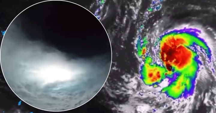
NEW YORK CITY, NEW YORK: Although Hurricane Lee is now listed as a Category 2 storm, experts warned that it could gain strength again, per the Daily Mail.
Hurricane Lee was a Category 3 storm with winds reaching speeds of 115 mph as of Saturday afternoon, September 9. It is heading westward at 10 mph, and its center is about 300 miles northeast of the northern Leeward Islands, per ABC News.
How strong is Hurricane Lee?
The storm doubled its rate of rapid intensification, according to the National Hurricane Center. A storm is said to rapidly intensify if its wind speed increases by at least 35mph in 24 hours.
According to Fox Weather, Hurricane Lee sustained winds of about 165 mph and gusts of almost 185 mph as of Friday morning, September 8.
Strong surges could send waves up to 10ft tall slamming against the eastern seaboard on Sunday, September 10, posing a threat of flash floods and building damage.
In a matter of hours, the storm's wind speeds increased from 80 mph to over 160 mph, alarming forecasters who deemed it a Category 5 hurricane overnight on Thursday, September 7.
The same thing happened during Hurricane Matthew in 2016 and Hurricane Wilma, which set a record. Wilma's winds rose from 75 mph (Category 1) to 185 mph (Category 5) in just a day.
The National Hurricane Center reported Hurricane Lee, which became the first Category 5 hurricane of the season on Thursday, had dropped to a Category 2 by Saturday as it made its way west through the warm waters of the Atlantic, per CBS News.
Even though Lee was waning, the hurricane center issued a warning that it was "expected to grow in size over the next few days."
"Dangerous surf and rip currents are expected to begin along most of the U.S. East Coast" starting on Sunday and then "worsen through the week," the hurricane center added.
The storm may "gradually restrengthen during the next couple of days," the center added.
What is Hurricane Lee’s current path?
According to the Hurricane Center, Hurricane Lee was 310 miles northeast of the northern Leeward Islands in the northeastern Caribbean at 5 p.m. on Saturday and was speeding up 10 miles per hour to the west-northwest.
It is the first Category 3 storm of the Atlantic hurricane season, with maximum sustained winds of 115 mph.
The hurricane was forecast to increase in strength on Sunday and Monday, September 11, but no change was seen on Saturday, as per the Hurricane Center, reports New York Times.
It does not currently pose a threat to any land, and there are no alerts in place.
However, extreme surf conditions brought on by the storm are reportedly anticipated to hit portions of the East Coast beginning on Sunday, according to the Hurricane Center.
Hurricane Lee is expected to stay north of the Caribbean, according to meteorologists.
The storm was predicted to veer northward by a number of forecast models, but it was uncertain if and when that would happen, or whether it would turn before posing an imminent danger to the US.


