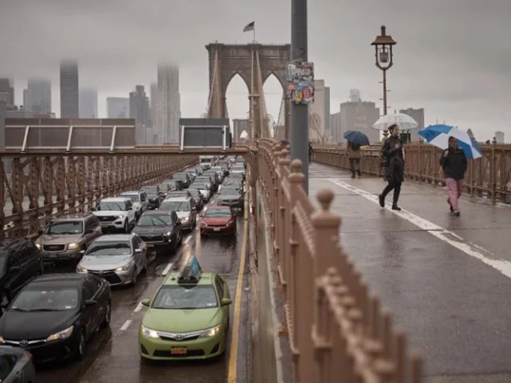
Prepare for another dose of wet weekend weather in the Northeast, but this time, the dreary déjà vu comes with a twist -- some snowflakes may fly in high elevations.
It has rained on a Saturday or Sunday in parts of the Northeast and mid-Atlantic every weekend since late August. Other locations have managed to stay dry for a weekend here and there, but have endured mostly dreary conditions for almost two full months.
In Philadelphia and New York City, this weekend is shaping up to be the seventh consecutive wet weekend, and the eighth wet weekend since late August.
It's not just been miserable. Wet weekend weather has also put a damper on vital fall foliage tourism in New England.
Why is the Northeast stuck in this seemingly-never-ending loop? Meteorologists say to blame the upper atmosphere, where a stubborn weather pattern has opened the door for storms to cross the region.
"We have these overall patterns that generally last roughly six to eight weeks with storm systems coming through every six to eight days," Sarah Johnson, meteorologist for the National Weather Service in Mount Holly, New Jersey, told CNN.
These storms are progressive in nature, which means they track across the country at a consistent pace without slowing down significantly or stalling.
It's largely a coincidence that this pattern is targeting weekend days, according to Johnson.
"If we had been luckier, or unluckier depending on how you look at it, and (the pattern) started on a Wednesday, we'd be seeing storms more in the middle of each week," Johnson said.
But there will be no such luck again this weekend, as two systems work together to bring soggy and dreary conditions to the Northeast and parts of the mid-Atlantic.
A storm and its associated cold front will move across the Great Lakes on Friday and push into the Northeast by Friday night. Meanwhile, a storm will begin to develop off the mid-Atlantic coast on Friday and send a plume of deep moisture into parts of New Jersey, New York and New England.
By Saturday, the coastal storm will get a boost of extra energy and become the primary weather-maker for the Northeast. Rain will persist across much of the Northeast as the coastal storm strengthens. Steady rain and even a few thunderstorms will target portions of New England on Saturday. Any rumbles of thunder are most likely in eastern Massachusetts, including Boston.
Saturday's rain is unlikely to cause any widespread flooding, but ponding on roadways or low-lying areas may occur in spots with multiple downpours.
Showers will linger for parts of the mid-Atlantic on Saturday, but the region will slowly begin to dry out. Friday is likely to be the wettest day of the next several for Philadelphia, but showers and clouds are expected to linger into Saturday. Wet weather is expected to span from Friday into Saturday night in New York City.
The coastal storm will track northward Saturday night through Sunday and wind speeds will increase, especially for coastal locations. Wind gusts of 20 to 30 mph will be common from late Saturday to Sunday from coastal Massachusetts to coastal Maine.
Temperatures will plummet on Saturday night and bottom out in the 30s or low 40s for much of the Northeast by early Sunday morning.
In high elevation areas like New York's Adirondack Mountains and the Green and White Mountains of Vermont and New Hampshire, tumbling temperatures could turn raindrops into snowflakes and a possibly slushy coating of snow Saturday night and Sunday.
Rain will continue elsewhere across New York and New England on Sunday before gradually tapering off Sunday night.
The storm is forecast to move away from the US on Monday, leaving the soggy region to dry out once more during the work week.
It's still unclear when the Northeast will be fully set free from this dismal loop, but there are signs of hope.
The Climate Prediction Center predicts near-normal precipitation amounts for the Northeast from October 27 to November 2, or through next weekend. This doesn't mean this period will be dry, but it does mean it's unlikely to be excessively wet.
To offer even more hope, meteorologists say patterns like the current one generally have a limited lifespan. Most last six to eight weeks and many locations have already spent at least six weeks in the dreary loop, so the end may not be too far off, Johnson told CNN.
But not all setups conform perfectly, so the streak could continue.
"It's sometimes a little more, sometimes a little less," Johnson said, describing the lifetime of a pattern. "We've been kind of stuck in this one."


